Acton town station opened in July 1879 to serve the District line extension from Turnham Green to Ealing Broadway. The station was rebuilt in 1910 and renamed Acton Town. Just twenty years later it needed to be rebuilt once again when the Piccadilly Line was extended. This time it was designed by Charles Holden who designed a number of Underground stations.  The station is built from reinforced concrete. The canopies above the platforms are supported by concrete piers decorated with roundels, poster boards or fixed seating.
The platforms are linked by a secondary bridge at the southern end.

 The link between the platforms and the ticket hall is decorated with enamelled information boards about the District Line and the underground.
The ticket hall has impressive double height paired windows.
 The station serves both the District and the Piccadilly Line. This map shows the 55 stations I have already visited on the District Line as well as the branch line going to Richmond which I have yet to visit.

From the outside you can see the double height windows more clearly with shops on either side of the square building completing its symmetry.
There are seven stations with the name Acton in them and not one of them is close to the town of Acton. However, one thing I have discovered on this little challenge of mine is that stations are not always where their names suggest. Other stations with the name Acton in them are East Acton, West Acton and North Acton which are on the Central line; Acton Central and South Acton on the London Overground and Acton main line which is a National rail station.
Just outside the station is this neat set of lockers containing folding bikes for hire.
Across the road from the station I could just about see over the wall and look down at the tracks going beneath the road bridge into the station.
To the side of the tracks is the London Underground Museum Depot.
The Museum Depot holds the majority of the Museum's collections which are not on display in the main Museum in Covent Garden. It is only open to the public for special events and open weekends so I will need to keep a look out as I would like to see inside.
I turned left out of the station and followed the signs to Gunnersbury Park via Gunnersbury Lane.
I followed the wall looking for the entrance to the park but foolishly followed it in the wrong direction missing the entrance and having to walk an unnecessary few hundred metres.
However, it was worth it as I entered an extensive mature parkland. Not what I had expected at all.
Gunnesbury is an important historic estate that was once the home of Princess Amelia, daughter of King George II. In 1835 it became the first country home of the Rothschild banking family who enjoyed the estate for 90 years. The park was purchased by the local councils and opened to the public by Neville Chamberlain, the Minister of Health in May 1926.
I walked towards the mansion which overlooks the lake and grounds.
The building is now a museum, exhibition centre and venue for hire. Due to Covid restrictions it was all closed when I visited which was a pity as I hoped the cafe would be open.
However, parked outside the front was a mobile cafe. Perfect for some tea and cake.
After a short tea break I had a refreshing walk around the formal gardens before making my way back along Gunnersbury Lane in the direction of the station.
 In the formal gardens the wisteria was in full flower.
I was making my way to the town centre. After passing the station I turned left onto Avenue Road and into the Mill Hill Park Conservation Area. The estate was founded by William Willett and his son in 1877. After purchasing the land, they immediately laid out three new roads and began to build houses.
The Willetts became the most prominent house builders in both Hampstead and Kensington in the late 19th century. Although they had architects working for them, the Willetts supervised and controlled every detail from materials to design. They also owned their own brickfield where the distinctive red bricks for the estate were made. Although the Willetts built homes as if they were on a production line they had very high standards and used master craftsmen which contributed to the 'excellent woodwork'. What I found really interesting about these builders was their attention to detail and standards which has been well documented. They had a 'Rule book' for foremen and contractors which had to be strictly adhered to. If only we had that nowadays!

The gate pillars and part of the boundary wall, built in the 1870s, surrounding the estate can still be seen. One important aspect of the houses they built was the abundance of window light: 'In all houses see that the basement especially is well lighted and that all basement and staircase windows are kept up as high as they possibly can be..' This interest in maximising daylight led the son, William Willett to write a leaflet in 1907 entitled 'The waste of daylight'. Today he is remembered as the promoter of daylight saving and British Summer Time. After researching the Willetts I realised that I had walked past William's memorial many times, a sun dial just a couple of miles from where I live!
Between two houses I noticed this gateway which welcomed me into Mill Hill gardens. This small garden was once for sole use by the residents where they enjoyed tennis, croquet and tea parties. Significant archaeological finds have been made here. Evidence of human settlement in this area have been traced back to the Bronze Age, the prehistoric era as well as Medieval, Saxon and Roman times. A Roman bowl was found in Avenue Gardens in 1981 and is now in the Museum of London.
As I continued down Avenue Road towards Acton High Street there was a distinct change in the type of housing. Instead of the tree lined avenues of large Victorian houses I was now in a densely populated area of high rise blocks of flats but here were other things to catch your eye.
This is the Acton Giant, a large mural painted on the side of a block of flats. It is a message to all children to Brush your Teeth! It is 38.2 metres (125 feet) tall and 14 storeys high and was painted by Thierry Noir. The project, which was co-ordinated by ARTification took one week to complete. It is part of an urban art project that tries to bring life to the otherwise grey buildings. The intention of the art is to brighten up the estate whilst extensive building work as part of the regeneration of the area takes place. I think it achieves that aim.
In 2018 a disused garage site was used to install these colourful, modular homes for homeless families
On one side of the homes is this kestrel painted above a wild flower meadow scene.
It was painted by Karen Francesca and ATM art. The art group has run workshops with local residents and artists and liaised with the local council in its choice of public art. The subject matter of murals is site specific. The collaboration between the local community and artists has been deemed a huge success.
Close by is Harlech Tower, built in 1968 along with two other identical tower blocks. In 1981 the tower was chosen to be used in the filming of a new sitcom, Only Fools and Horses. It was used as the exterior scenes of 'Nelson Mandela House' from 1981 to 1985. It was decided that the estate it was on was 'very working class' and perfect for a market trader (played by David Jason) who lived in a flat in a tower block. Harlech Tower appeared in the opening titles of every episode ever made, long after filming moved to a tower block in Bristol from 1988 onwards.
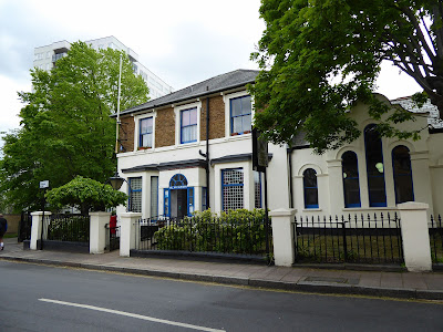
This attractive, white painted church with blue highlights is the local Baptist church built in 1856.

This is Acton Library built over a hundred and twenty years ago with a grant of £4000 from the philanthropist J Passmore Edwards. The library was provided with some 8000 books which were housed in a closed room. You had to request to borrow a book from the catalogue. The library also had a reference room, a magazine room and a newspaper room. As I travel around London the name of Passmore Edwards is evident on numerous buildings. John Passmore Edwards was born in Cornwall in March 1823, the son of a carpenter and was educated at the local village school. He went on to become a journalist, newspaper owner and Member of Parliament. He made his money from the purchase of a number of successful publications and the first London daily halfpenny newspaper 'The Echo'. Always a champion of the working classes he founded 24 libraries as well as the establishment of more than 70 major buildings as a result of his bequests. These included hospitals, schools, convalescent homes and art galleries. He died in April 1911.

The library closed in 2014 and there are plans to repurpose the building as a new arts complex with cinemas and community facilities. A new library has been incorporated into another building close by, the old King's Rooms.
At the beginning of the 20th century, Acton's district Council wanted their own town hall, bringing all their offices under one roof. The new town hall was officially opened in March 1910 but wasn't big enough and by 1935 it was extended and renovated to its current size. But with the reorganisation of London boroughs in 1965 there was no need for Acton to have its own large town hall. Eventually the Grade II listed Acton town hall was redeveloped into residential housing. Altogether the building is now made up of 71 apartments, 58 of which are in the original building and 13 in a carefully designed extension annex.

The coat of arms of the former Borough of Acton (granted 1921) as displayed on signs installed in 1998. The arms portray the elements of scholarship, industry, the arms of Middlesex and the oak tree for the supposed origin of the name of Acton - "Oak Town".
This building used to be known as the King's Rooms. There were two swimming pools and personal bathing facilities which were all floored over during the winter and the rooms were used as a dance and concert hall. The pools were built in 1904 with this entrance added in 1926.
In 2011 Ealing Borough Council gave permission for the demolition of the Acton baths building but retained the King's Rooms façade. In its place was built a three storey building comprising of new swimming pools, fitness centre, community facilities, library and reception hall.
I walked a bit further along the High Street to look at this old cinema. It used to be called the Dominion and then the Granada. It was opened in 1938 and by 1939, the Odeon in King Street and the Savoy in East Acton had also been opened. The Dominion was bought by Granada in 1946 and renamed becoming a bingo hall by 1977. The art deco style of the building has been retained and renovated and the building is currently an indoor climbing centre.
I felt I had walked far enough down the High Street and decided to walk through Acton Park to do a circular route back to the station. Acton park was first opened to the public in 1888 to commemorate the Golden Jubilee of Queen Victoria. Many areas of the park were purchased from the Goldsmith company in the late 1800s and merged to create the park.
Across the road from the park are these almshouses. A scheme was set up in 1808 for the erection of twelve almshouses on land that had been bequeathed to the Goldsmiths' Company. An additional eight houses were added in 1838. The alms people were chosen from the 'Settled Pension List' and were always the oldest on the list. They each received £100 a year in addition to their regular pensions and 1 or 2 cauldrons of coal. Rules and regulations were strictly adhered to such as the attendance at church twice every Sunday.


I turned left out of the park on to Churchfield Road and was surprised to see a level crossing ahead. You can just see the train crossing the road. I don't often see these in London. A level crossing is where a road crosses a railway line. Level crossings are usually demarcated by signs, lights and other safety measures such as barriers and gates. There are about 45 level crossings in the Greater London area. There are numerous accidents each year some of which are fatal. Nearly all accidents are caused by driver error particularly drivers trying to cross despite the warning lights and barriers being lowered.
Once the train had safely passed through, the barriers were raised and the cars went on their way.
I then walked across and couldn't resist taking a photo of the rail tracks.
At the other side of the Level Crossing is Acton Central station which is on the London Overground system. The Station House was once the ticket hall but is now a pub/restaurant.
There were a number of shops close to the station with the usual coffee shops. The shops were busy and the area had a community feel about it.
I continued down Churchfield Road stopping to have a look at St Mary's Burial Ground. A cemetery was established here in 1863 on just one acre of land to provide additional burial land for the parish church of St Mary, a couple of hundred of metres away. The land had been part of a field called Conduit Close that had a number of springs, providing the village with water. By 1929 the cemetery was almost full. In 1979 the burial ground was converted into a public garden laid out with a paved area and seating.
A short walk passed a supermarket, brought me to Acton town with St Mary's church at its centre. A settlement at Acton is mentioned in the Doomsday book of 1086 and the church of St Mary's is first recorded from at least 1231.
The original medieval building was enlarged to include a nave and then at a later date a tower was added. This present church dates from 1866 when a much larger church was needed to cope with the increased population of Acton. The church was the focus for the giving of money and property for the giving of alms and for the maintenance of a clean water supply.
Near the north-west door of the church is the Acton Pump. This pump had replaced the Thorney Conduit water troughs in 1819. The Conduit troughs (1610) were fed from an Ancient Well which was located in the field where St Mary's burial ground is now sited. The pump was paid for by William Antrobus (1797-1853), a rector of the church, so that fresh water would be available for the residents of Acton.

Opposite the pump is the Acton Milepost. It was saved during road widening and relocated next to the door of the church when the pump was restored. Distances were measured from Tyburn (Marble Arch). Although only five miles from London, the state of the roads in previous centuries was so bad that Acton was at least half a day's travel. This led to the opening of a number of inns and taverns and the village of Acton became a stopping place for refreshments on the busy road from London to Oxford. The earliest recorded inn being 1337. It was now time for me to go in search of refreshments. I had enjoyed looking around Acton and once again was surprised by what I had discovered from the beauty of Gunnersbury Park, the height of the Acton Giant mural to a suburban level crossing.


 Ealing Common has been here as far back as records exist. From the Middle Ages the common belonged to the lord of the manor, the bishops of London. they allowed the tenants to graze cattle on the common. manorial rights were transferred to the Ecclesiastical Commissioners in the 19th century.


