


A replica of a poster from 1993.

Canning Town station also services Docklands Light Railway (DLR). The first part of the new station opened in October 1995 serving the North London Line ( now part of the London Overground service). The DLR platforms opened in March 1998 and the Jubilee Line platforms opened in May 1999. The DLR is an automated light metro system serving the redeveloped Docklands area of London. It first opened in August 1987 and has been extended multiple times. The tiered design of the station has platforms on different levels with the DLR platforms above the Jubilee Line platforms.


When the line was extended in 1999 eleven new stations were constructed. While the stations were designed by different architects they were all constructed from the same materials. The concrete, glass and brushed steel giving the stations a different identity from the majority of the stations I've previously visited. The new station was built on the south side of the busy A13 road and has two entrances/exits. One takes you out to the bus station and this circular exit brings you out at Bow Creek.


I turned right leaving the station and crossed this 80 metre red bridge over the Lea River's meander, known as Bow Creek.

From the bridge I could see a DLR train arriving at Canning Town station.

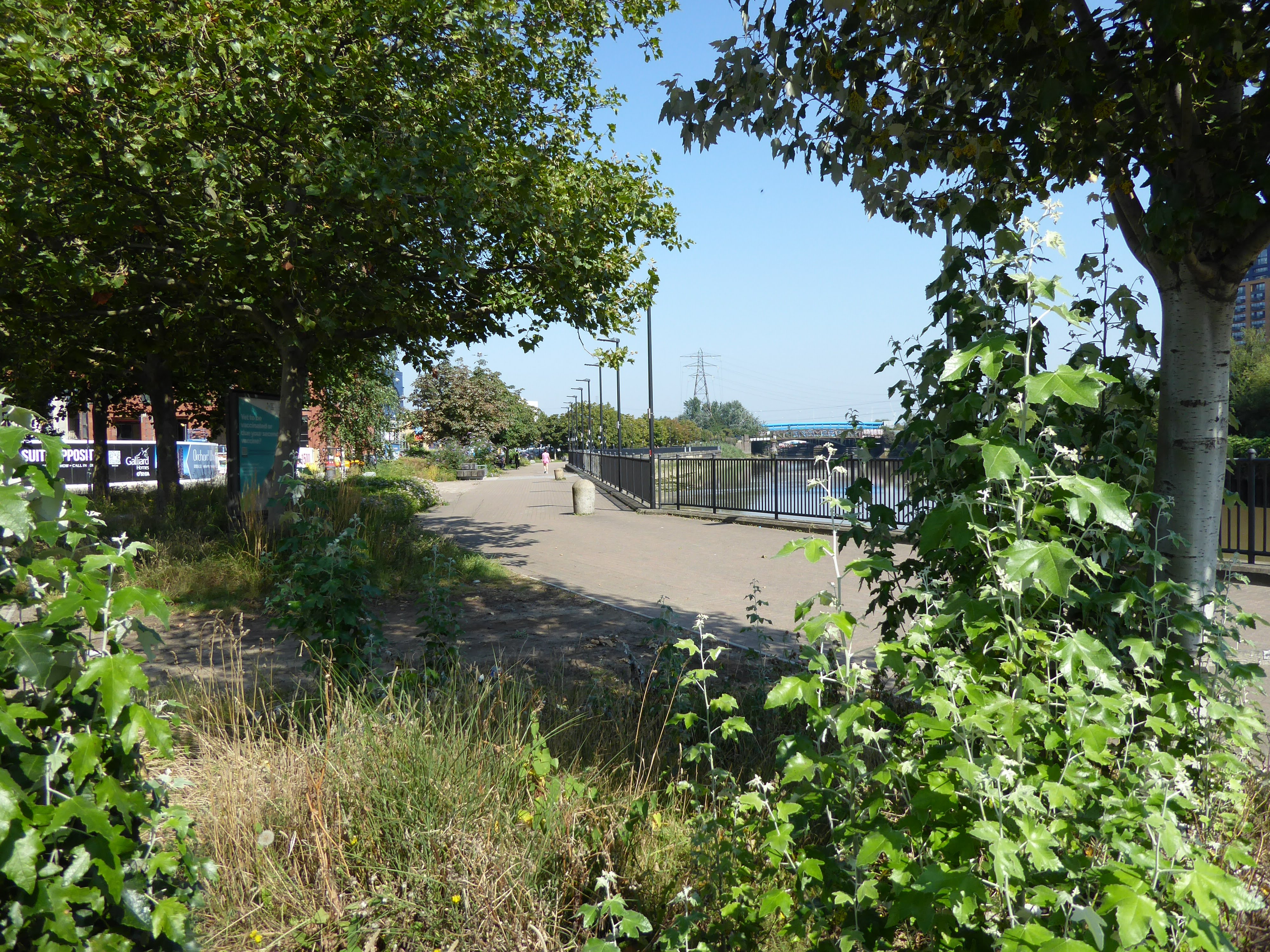
This shows the walkway in front of the station following the River Lea towards the Royal Albert Dock. You can see numerous cranes building yet more office blocks and residential apartments.

Following the walkway in the other direction takes you towards the financial district of Canary Wharf and even more cranes.

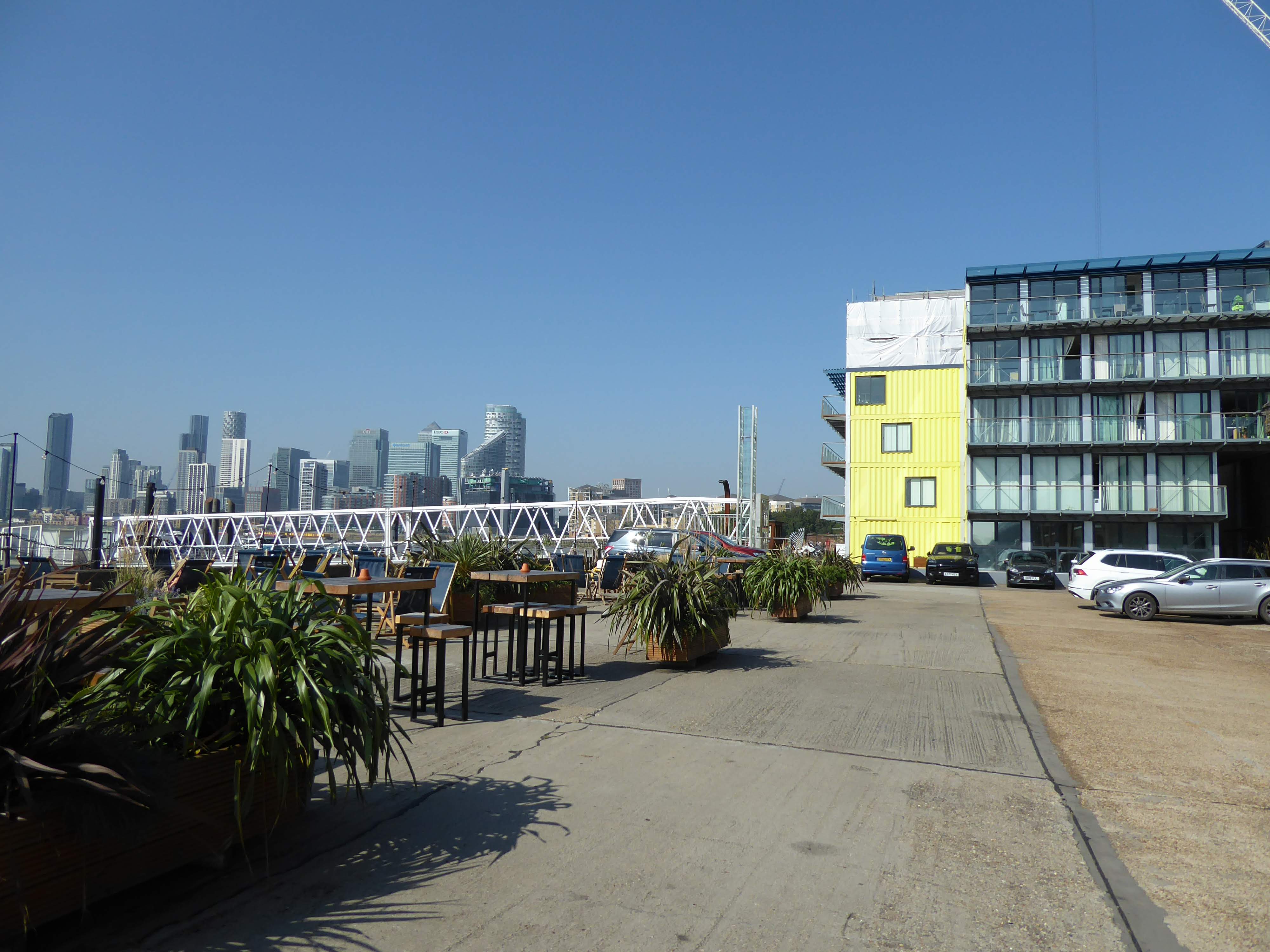
The bridge takes you to City Island. This is a new 14 acre riverside development of approximately 1700 new apartments. It is ideally situated being close to the financial area of Canary Wharf, City airport and of course the Jubilee Line and the DLR. I had never heard of it before and with most new developments in London it seems to have sprung up overnight.

City Island is located on a peninsula between the River Lea and the Thames so not strictly an island but is mainly surrounded by water.

Canning Town once had a strong industrial heritage. By 1855 Canning Town had a new dock, the Royal Victoria Dock. However the local water supply and sewage system couldn't cope with the increased number of residents and new businesses and the area became known for its slum living conditions. By the 1930s housing conditions were so dire that the local council started to clear the slums and provided new housing, medical clinics and nurseries. The area was badly affected by the second world war when it was estimated that over 85% of local housing was destroyed. Due to redevelopment plans after the war much of Canning Town is made up of relatively modern new council estates many of which include high rise blocks. However the new developments here on City Island have nothing to do with social housing. As far as I could see this area is for the relatively young and wealthy

The island has ten residential blocks each with strongly coloured structural frames.

There are trees and seated areas surrounded by greenery.

Amidst the residential blocks are other buildings such as The English National Ballet's new headquarters. There are seven rehearsal studios as well as a production space to stage performances.

There are art galleries as well as bars and restaurants.


The East India Company was founded in 1600 and was a powerful trading company that helped to establish British rule in India in the 18th and 19th centuries. The company docked at Blackwall for many years and in 1804 a large dedicated dock was built for the company's trade.

The company had sole use of the docks until 1833 when they were disbanded and from then on the East India Docks were used for all trades. The dock basin was gradually extended and new locks built but in the last 50 years or so there has been a decline in the use of London docklands and the East India Dock closed in 1967. The Import and Export docks were gradually filled in and built upon and the Basin was turned into a nature reserve.


The basin currently consists of an open area of water surrounded historic dock walls and a Grade II listed lock into the River Thames. It is hoped that heritage funding can be raised to improve facilities for visitors to the Basin.


I left the nature reserve at East India Dock and carried on round to Trinity Buoy Wharf and walked past these original warehouses with a new development rising up behind and across the road. I thought the signs on the wall looked good and realised that they have been repainted onto the walls possibly this is what they used to look like, but looking at photos I took of this area in 2014 I cannot see any evidence of these signs then.

Good Luck Hope is the name of the new development. Before development ever took place here, the peninsula was one of the least accessible parts of Poplar by road. At the end of the 18th century the peninsula consisted of two freehold estates named Orchard House and Good Luck Hope. The road where I took this photo is called Orchard Place and leads you to Trinity Buoy Wharf.

The former estate of Good Luck Hope is where the new London City Island is located and continues up to the left of this road where more construction is taking place. The name goes back to the 14th century when it was called 'Godluckhope'.


This piece of art work was fixed to one of the old warehouse walls.

This sign was there a few years ago although it is looking much cleaner now. Trinity Buoy Wharf was an industrial area situated next to the old East India Dock. Between 1803 and 1988 wooden buoys and later iron buoys were made and repaired in the workshop by the river. You used to see some of the buoys on the street leading to the wharf.

I took this photo a few years ago on my last visit here.
In 1998 the place was derelict but now it is a lively, busy place incorporating creative art studios, a school, gym and a container city alongside the historical 19th century brick built buildings. The brick buildings are the heritage structures built by and for Trinity House, the organisation that designed, built and maintained the navigational equipment, buoys, lighthouses and lightships that kept the coastal waters around Britain safe.

One of the wharf's most famous features is this lighthouse, the only lighthouse in London. However, this was not used for guiding ships away from rocks but was an experimental lighthouse to develop lighting for lighthouses and lightships. It was also used to train lighthouse keepers. Originally there were two lighthouses here. The first one built in 1854 was used by Michael Faraday for experimenting on lighting to be used along the Kent coastline. That one was demolished in 1920s. This surviving lighthouse was built in 1864.

Next to the lighthouse is a small museum devoted to the work of Michael Faraday. In 1836 Faraday was appointed as Scientific advisor to Trinity House, a post he held until 1865. Originally a voluntary association of shipmen and mariners. Trinity House was granted a charter by Henry VIII in 1514 and is still responsible for safe navigation around the coast. Faraday worked on the electrification of lighthouses for them in the early 1860s.


In front of the Lighthouse is Fat Boy's Diner, made from an old container and unbearably hot inside on the day I visited


These two figures looking as though they are holding up the staircase outside the Trinity art school are also by Andrew Baldwin.


This is Lightship 95 which spent most of its life guarding South Goodwin Sands, part of a series of sandbanks in the English channel feared by seafarers from around the world. The Goodwin sands have claimed hundreds of ships and thousands of lives. The Lightship was in service until 2003. Whereas most ships would stay in harbour during bad weather, lightships had no choice but to remain at anchor. As a result they were heavily built to very high standards. This is possibly one of the last examples of an all-riveted steel ship built to withstand all weather conditions and frequent collisions. The ship is classed as a heritage vessel. The ship has now been converted into a recording studio but before that could happen a large amount of steel had to be cut out and removed. The conversion from ship to studio sounded a very complicated engineering nightmare mostly carried out on the River Medway before being permanently moored here.


I was looking for the Lea Valley trail which runs along the other side of the river from the City island. On this photo you can see the Dockland Light railway which runs on overhead railway lines. I was able to pick up the trail on the other side of the railway lines.
The Lea Valley walk is 53 miles long from the source of the River Lea near Luton to the Thames at Limehouse Basin. The walk passes Nature reserves, such at the one I mentioned earlier, riverside villages and also goes through the Olympic park. I have walked a few sections of it in the past but not all of it.


The path took me onto the flyover which I had assumed was not for pedestrians but there was clearly a path at the side of the road although I must admit I was glad when I followed the signs taking me away from the road.


 I needed to cross the flyover but this time I went beneath it!
It brought me out to Canning Town's High Street (Barking Road). The area is thought to be named after the first Viceroy of India, Charles John Canning.


This Grade II building used to be the Royal Oak pub. It used to have a boxing ring on the first floor. After a number of reincarnations it is now a Turkish restaurant.


The two buildings were designed as a single development built in 1892-4, although they were never connected to one another. The Public Hall is the grander of the two with its three floors compared to the two floored Library. When East Ham and West Ham merged to become Newham Borough Council in 1965, the hall became an adult education institute. By 1989 the hall had been abandoned but was restored and revived by a local charity, which from 1993 ran it as a community centre. A notice on the door of the library says it has now moved but gives no information about the future for this building.


The focus of regeneration in this area seems to be housing rather than shopping malls.


If you ever make a book of your discoveries around the subway stations it will be very informative and not pocketable for the curious traveler exploring your walks. Still great work and keep them coming.
ReplyDeleteanother fun excursion - thank you!
ReplyDeleteInteresting, the area modern and very built up, it seems to hide the history of the area. So that is the River lea that Adele sung about
ReplyDeleteYou are such an intrepid explorer!! I love the constant repurposing of buildings and land.
ReplyDeleteIt is rather a contrast to much of London. We of course are a little familiar with the some of the area, especially the Trinity Buoy Wharf. There was a nice cafe there, preferable to a hot metal container.
ReplyDeleteI had forgotten about the beacons being lit in 2000.
Now I am so disappointed to learn the tree in the taxi is a sculpture and not a real tree, as I assumed.
I can't say it was our favourite part of London but it is good to see it through your eyes.
Wow! What a photo and walking adventure for you and us ~ Thank you so much ~ awesome !
ReplyDeletexo
Living in the moment,
A ShutterBug Explores,
aka (A Creative Harbor)
Goodness me you did a lot at this station. I admire your sticking at it attitude. Well done. We rode on the docklands train without a driver it was quite an experience.
ReplyDeleteOh wow! I'm sure it's been a lot of learning.
ReplyDeleteThank you for taking us along. Happy exploring.
I'll be back next week (or whenever it is up :) to see the mounds you were taking about. Have a lovely week. :)
You are finding out so much about the city! Wonderful photo journalling, I love the photos of the bridge, wonderful perspective!
ReplyDelete-Soma
That's neat all the old signs are still there and you walked a long way too. I think I would get annoyed with all the building noise too.
ReplyDeleteSo many interesting things withing walking distance. I've never heard about light ships, but they make sense for places that don't have a shore location. - Margy
ReplyDeleteI am always amazed by the extensive rail system there and the diversity of the locales. The lightship was interesting to see and the interesting railing being "held up" by the manikins--very clever!
ReplyDelete